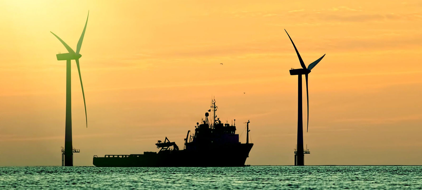

Energy - Renewables
Subsea 3D LiDAR Technology: A New Level of Insight
Highly accurate marine hydrographic, geophysical and environmental surveys are critical to the success of large-scale offshore renewable projects. From offshore wind turbines, to tidal and wave powered installations, 3D at Depth’s subsea LiDAR (SL) laser technology allows clients to map, inspect, monitor and evaluate underwater cables, assets and resources on levels not achievable by traditional acoustic and 3D multibeam methods. Our subsea LiDAR systems and Survey Support Services provide solutions across the lifetime of the field in the following areas.
- Early stage environmental assessments and pre-installation surveys
- Subsea cable and pipeline route surveys
- Environmental assessments and monitoring
- Scour assessments and monitoring
- Site investigations and baseline audits
BROCHURE DOWNLOAD

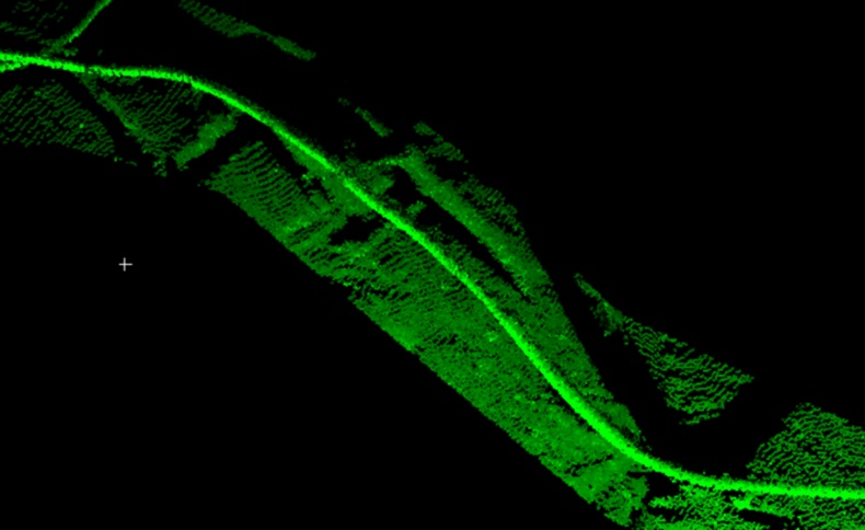
Subsea Cable Route Surveys
Our Subsea LiDAR (SL) systems and Survey Support Services deliver a wide range of client deliverables to help offshore wind renewable projects design, engineer, build and maintain cost-effective and reliable installations.
Precise mapping and detail seafloor surveys of cable corridors allow project engineers to design cost-efficient, practical and safe routes for their installations. Cable route surveys require accurate, precise, measurable information of the topography of the seafloor to correctly identify optimum routes and lay barge anchor pattern routes. Hazards that include wrecks, man-made artifacts, marine debris and dumping grounds are identified to ensure that cables are not laid in potentially dangerous or compromised areas. Once the cables are laid, long term monitoring and evaluation are required to ensure cable integrity and condition.
Precise mapping and detail seafloor surveys of cable corridors allow project engineers to design cost-efficient, practical and safe routes for their installations. Cable route surveys require accurate, precise, measurable information of the topography of the seafloor to correctly identify optimum routes and lay barge anchor pattern routes. Hazards that include wrecks, man-made artifacts, marine debris and dumping grounds are identified to ensure that cables are not laid in potentially dangerous or compromised areas. Once the cables are laid, long term monitoring and evaluation are required to ensure cable integrity and condition.
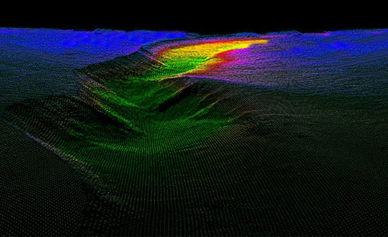
For baseline scour assessments and monitoring, subsea LiDAR (SL) technology provides more advanced highly accurate 3D data sets compared to traditional acoustic multibeam methods. During the early stage of a project installation, a baseline audit can be conducted to establish the conditions of wind turbine underwater structures and substations. The seabed and subsea infrastructure can then be surveyed on a routine basis to create condition monitoring and evaluation. Much of the data can be accessed topside in near real time to help increase survey efficiencies.
The subsea LiDAR 3D data sets can be exported into any existing GIS system or CAS based platform for measurement, evaluation and analysis. Long term condition monitoring can be documented and reviewed on a regular basis to help reduce project risks.
The subsea LiDAR 3D data sets can be exported into any existing GIS system or CAS based platform for measurement, evaluation and analysis. Long term condition monitoring can be documented and reviewed on a regular basis to help reduce project risks.
Scour Assessments and Monitoring
Monitor, Manage and Evaluate