


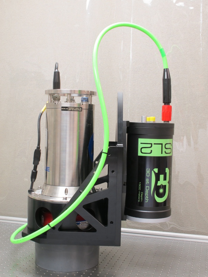
Dynamic LiDAR Moving Platform
Speed, Accuracy and Coverage
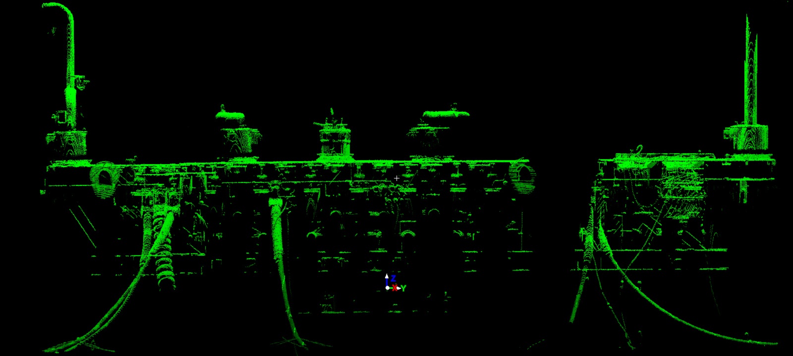
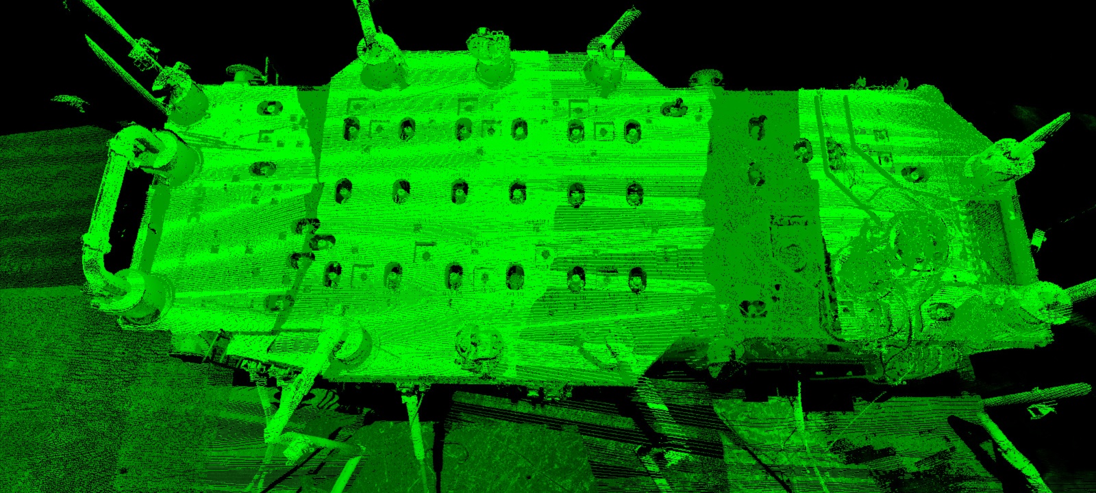
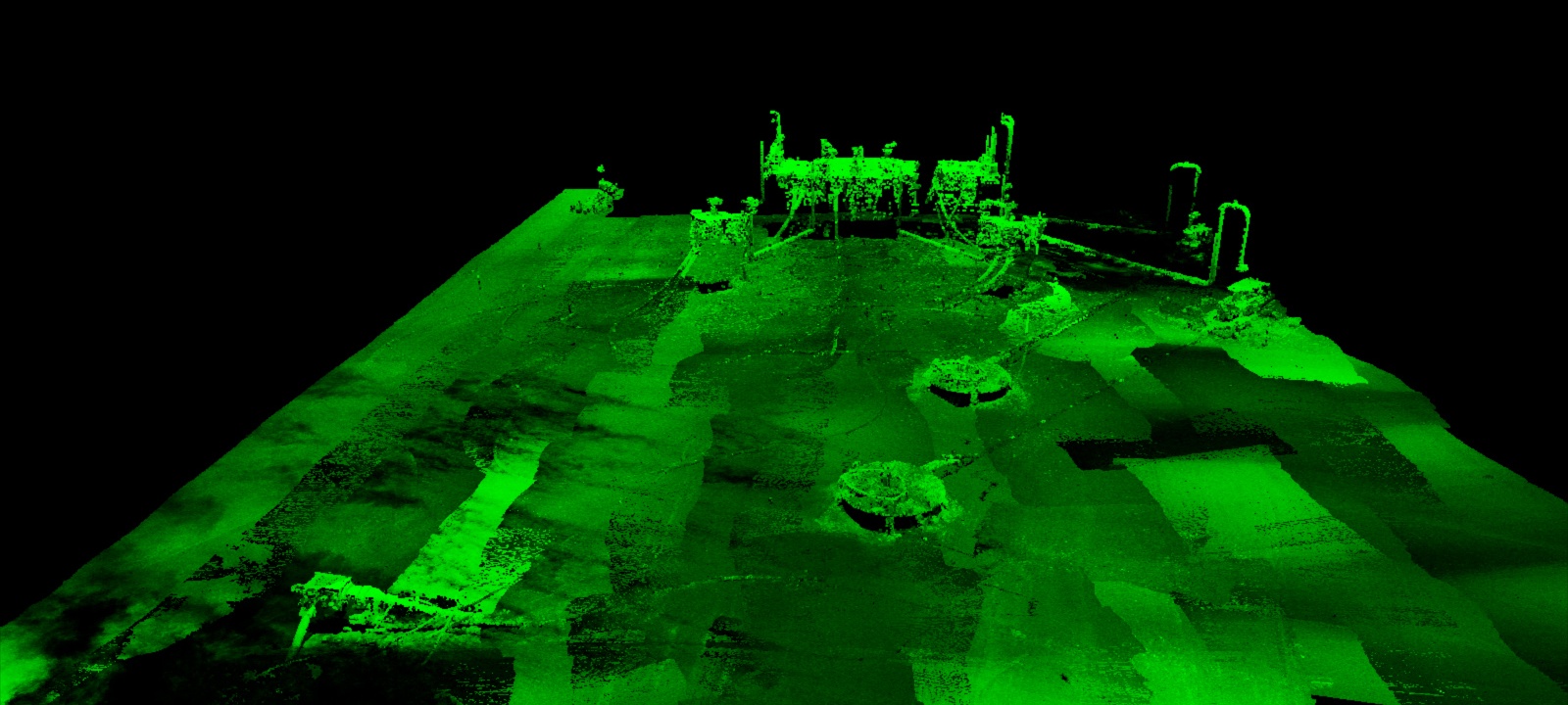
The Dynamic LiDAR Moving Platform is a tightly coupled subsea LiDAR and Inertial Navigation System (INS) data collection technology that increases subsea survey efficiencies in terms of speed, accuracy and coverage. The mobile mapping solution leverages the unique features of subsea LiDAR’s controllable beam by providing a number of different scan patterns. Data collection resolution can be configured by the user for defined cross and forward track resolution. These features allow for longer range, repeatable measurements with normal standoff distances at 15m or more. Highly congested areas, sensitive environmental, archeological and historical sites can be mapped with less risk to the protected area.
Accurate, Precise, High Density 3D Point Clouds
Easy integration into existing GIS and CAD based platforms
Flexible Deployment and Integration
ROVs, AUVs, Surface Vessels
Multiple Scanning Heads per Vehicle
Forward/backward/sideways/downward beam directions
Controllable Beam
Cross track resolution, configurable/multi-scan patterns
Depth Rating
3,000m standard (4,000m optional)
Reduce HSE Risk
Increased range, low impact and environmental footprint
Dynamic LiDAR Product Sheet
