


3D LiDAR Underwater Laser Systems and Subsea Survey Support Services
Subsea LiDAR: Control the Beam, Control the Data, Control the Return
3D at Depth, Inc. is the world's leading expert in subsea LiDAR laser technology. Our advanced subsea LiDAR laser (SL) systems and subsea survey support services help customers transform the value of underwater 3D data. From data collection and processing, through visualization and analysis, 3D at Depth delivers precise, accurate, repeatable, millimetric 3D point clouds to measure, map and evaluate underwater assets and environments.
Increase Survey Efficiencies
Measure in 3D, Manage in 4D
Total Asset and Environmental Awareness
Reduce Operational Costs
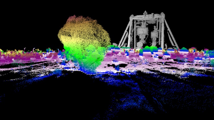
3D Underwater High Accuracy Survey Data
Modeling and Measurement of Structures and Seabed Topography
Offshore 3D LiDAR Data Collection, Management, Visualization and Analysis
Next Generation Digital Oilfield
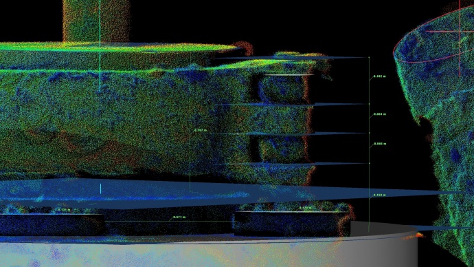
Metrology
Measure in 3D, Manage in 4D
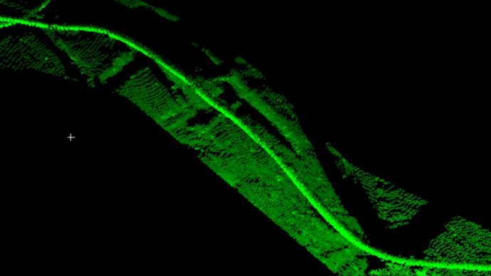
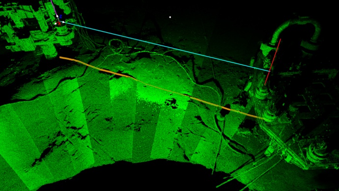
Cable Survey
Offshore Wind Renewable Energy
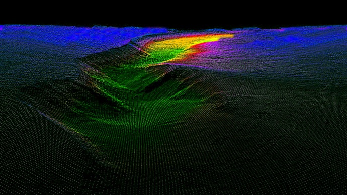
Scour Assessments
Environmental Surveys
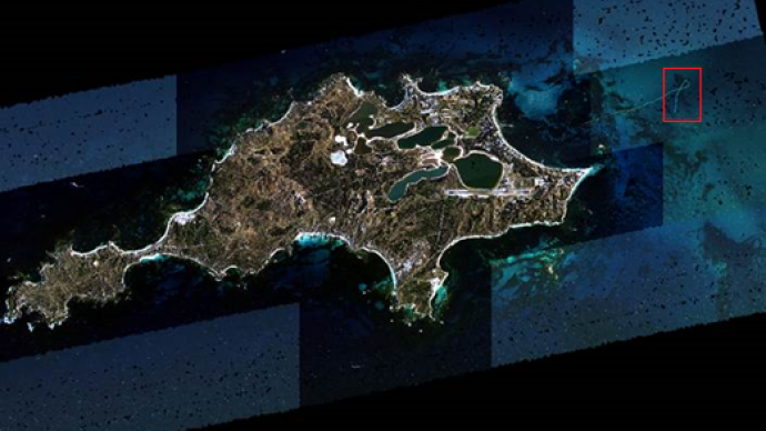
Survey of Kingston Reef, Australia
(A collaborative project between CSIRO and 3D at Depth Pty Ltd under the Geomorphology Work Package of the AIM FSP)
Marine Habitat Surveys
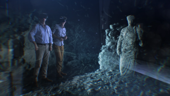
Underwater 3D Scans of Naples
BBC's "Italy’s Invisible Cities,” hosted by Alexander Armstrong and Dr. Michael Scott.
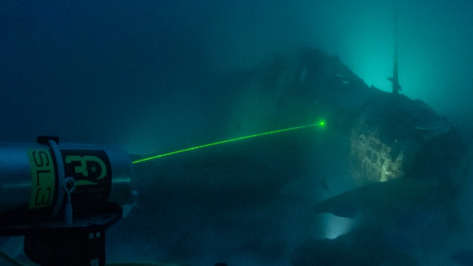
Nautical Archaeology Wrecks and Structure Scans
Introducing the "TBD Devastator" resting inside the Jaluit Atoll
Dynamic LiDAR
Subsea Metrology and Field Mapping
One Tool, Multiple Applications
One Cohesive Data Set
Long Range - Up to 45 meters
Vibration - Up to 20kHz
Leak Detection
Asset Integrity
Touchless, Non Contact
3D Measurements and Scans
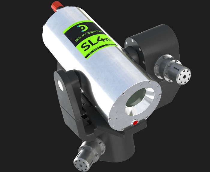
SL4 LiDAR
New Titanium Subsea Rated Housing
6X Faster Scanning speeds
New Compact Onboard Electronics
Depth Range 3,000m or 4000m
Pan and Tilt Movement
Range Accuracy (+/-) <1mm
Subsea Real-Time Processing